
-

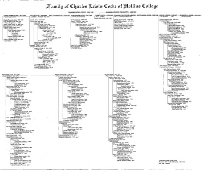
Family of Charles Lewis Cocke of Hollins College
Albert Kirven Cocke
Genealogy chart of the Cocke Family, begining with Charles Lewis Cocke (1820-1901) and Susanna Virginia Pleasants Cocke. (1820-1906), of Virginia.
-

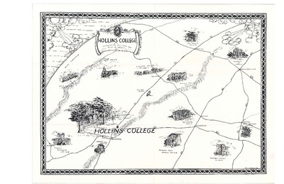
Hollins College with Surrounding Colleges and Other Points of Interest.
Hollins College
Map shows driving routes to other schools (prior to Interstate 81). It is illustrated by a representative building for each school or "other points of interest."
-

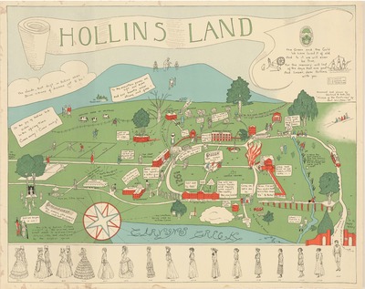
Hollins Land Map
Gertrude R. Rath and Bell Worsham
Designed and drawn by Gertrud R. Rath, Class of 1922.
"Frieze of the centuries" (based on Godey's Ladies Book fashion plates) drawn by Bell Worsham, Class of 1929,
Date: ca. 1929
Dimensions: 28.5 x 22 inches
Notes: Map features physical and architectural features of the campus. It also includes many individuals, long associated with Hollins, as well as references to traditions.
Printing is not supported at the primary Gallery Thumbnail page. Please first navigate to a specific Image before printing.